Curiosity Navigation Curiosity Mission Overview Where is Curiosity? Mission Updates Science Overview Instruments Highlights Exploration Goals News and Features Multimedia Curiosity Raw Images Mars Resources Mars Missions Mars Sample Return Mars Perseverance Rover Mars Curiosity Rover MAVEN Mars Reconnaissance Orbiter Mars Odyssey More Mars Missions All Planets Mercury Venus Earth Mars Jupiter Saturn Uranus Neptune Pluto & Dwarf Planets 2 min read
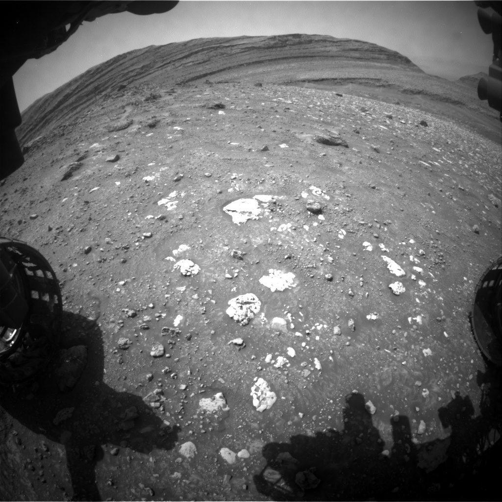
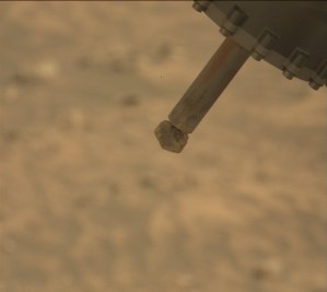
Sols 4241–4242: We Can’t Go Around It…We’ve Got To Go Through It!  This image was taken by the Front Hazard Avoidance Camera (Front Hazcam) aboard NASA’s Mars rover Curiosity on Sol 4237 – Martian day 4,237 of the Mars Science Laboratory mission – on July 7, 2024 at 14:46:38 UTC. Earth planning date: Wednesday, July 10, 2024
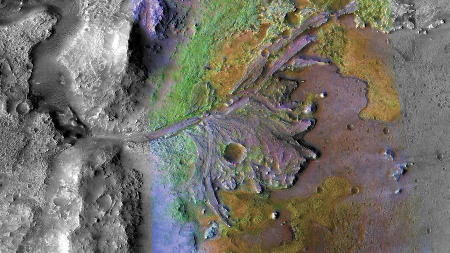
Curiosity is currently trekking across Gediz Vallis channel because, as my nephew’s favorite book says, if we can’t go around it… we’ve got to go through it! Recently we’ve been parked for a while on the channel to drill “Mammoth Lakes,” (https://science.nasa.gov/blogs/sols-4222-4224-a-particularly-prickly-power-puzzle/) and are now on the move once again exploring the rubbly rocks. Today the science team planned two sols of activity for Curiosity as we venture on through and across Gediz Vallis channel.
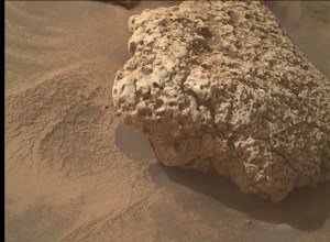
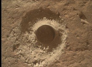
On the first sol we undertake nearly two hours of planned science. This includes Navcam deck monitoring and a Mastcam tau, to measure dust in the atmosphere as part of our atmospheric and environmental activities, alongside some geology-focused observations. MAHLI is taking a close up image of “Donohue Pass” that we targeted with ChemCam LIBS and Mastcam imagery in the previous plan (https://science.nasa.gov/blogs/sols-4239-4240-vuggin-out/). ChemCam will take a LIBS on a rock named “Negit Island” that caught the team’s eye with a lighter base and a darker upper section. ChemCam will also take two RMIs of Gediz Vallis, one to document the wall of Gediz Vallis channel that we can see up ahead of us, and one looking at the rocks that sit within the channel. Mastcam is also taking a look at the wall of Gediz Vallis, as well as continuing a mega-mosaic started in the last plan that took 54 images of “Stubblefield Canyon.” Today we planned another 48 images to document the rest of this area named “Echo Ridge.”
ChemCam will take a passive observation of an interesting rubbly target in this region called “Wishbone Lake,” prior to a five-meter drive (about 16 feet) over to this feature. Once we have arrived, Curiosity will take some post-drive Navcam imaging and a MARDI image of our left-front wheel. After a well-deserved sleep, on the second sol of this plan Curiosity will automatically choose a LIBS target in our new workspace, before taking a dust-devil and suprahorizon movie to round off this plan.
Written by Emma Harris, Graduate Student at Natural History Museum, London
Details Last Updated Jul 12, 2024 Related Terms Blogs
 2 min read Sols 4239-4240: ‘Vuggin’ Out’
Article
2 days ago
 2 min read Sols 4236-4238: One More Time… for Contact Science at Mammoth Lakes
Article
6 days ago
 2 min read Sols 4234-4235: And That’s (Nearly) a Wrap on Mammoth Lakes!
Article
1 week ago
Keep Exploring Discover More Topics From NASA Mars
Mars is the fourth planet from the Sun, and the seventh largest. It’s the only planet we know of inhabited…

Explore this collection of Mars images, videos, resources, PDFs, and toolkits. Discover valuable content designed to inform, educate, and inspire,…
Each robotic explorer sent to the Red Planet has its own unique capabilities driven by science. Many attributes of a…

Mars Exploration: Science Goals
The key to understanding the past, present or future potential for life on Mars can be found in NASA’s four…