2 min read
Preparations for Next Moonwalk Simulations Underway (and Underwater) 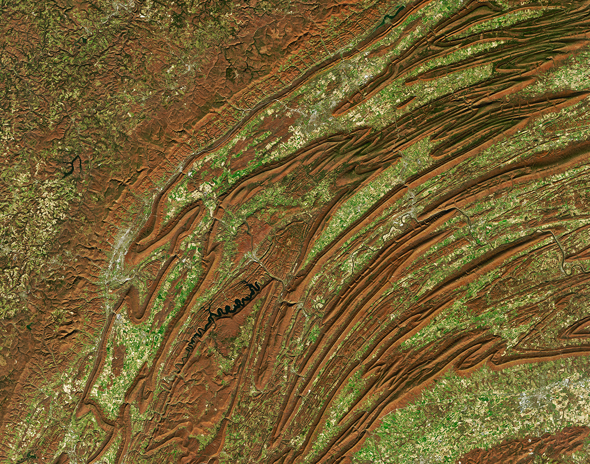 This natural-color image of mountains of central Pennsylvania taken by Landsat 8 shows the colors of changing leaves and the unique topography of the region. Thanks to more than 50 years of planetary observation from low-Earth orbit, it’s possible to see natural changes and those engineered by humans.Credit: NASA Natural disasters like volcanic eruptions, floods, and tornados can dramatically change the surface of Earth to the point where alterations are visible in space. Changes driven by human actions and interventions, such as mining and deforestation, are also visible in satellite imagery.
For over 50 years, NASA’s Landsat satellites have recorded our planet’s changing surface. Now, terraPulse Inc., a North Potomac, Maryland-based company, applies artificial intelligence to create meaningful maps to help academic institutions, nongovernmental organizations, and businesses understand the many impacts of climate change.
By combining data from multiple NASA and European satellites, terraPulse helps businesses make data-driven decisions regarding ecological impacts. That same data helps scientists understand environmental changes and the processes driving them, which can provide practical information to local decision-makers for infrastructure planning and disaster preparedness.
Measurements taken from space are still undergoing significant research and development. NASA’s Earth Sciences Division funds several remote sensing initiatives to expand our understanding of the impact of land cover change, including a terraPulse effort using FitBits to track and assess the health of wild deer and the impacts of their habitat change.
NASA’s Goddard Space Flight Center in Greenbelt, Maryland, which manages many of the agency’s Earth-monitoring satellite missions, supports a comprehensive view of our planet. Industries are looking to satellite data to plan for resilience to climate change by monitoring worldwide facilities, identifying manageable risk factors, and more.
 5 min read Astronauts To Patch Up NASA’s NICER Telescope NASA is planning to repair NICER (Neutron star Interior Composition Explorer), an X-ray telescope on…
Article 3 hours ago
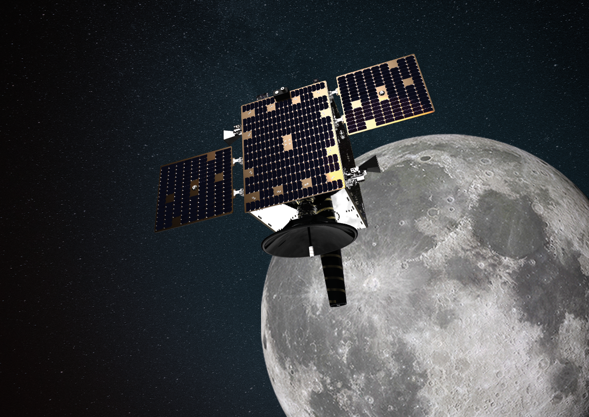
 3 min read NASA’s Roman Space Telescope’s ‘Eyes’ Pass First Vision Test Article 3 hours ago
 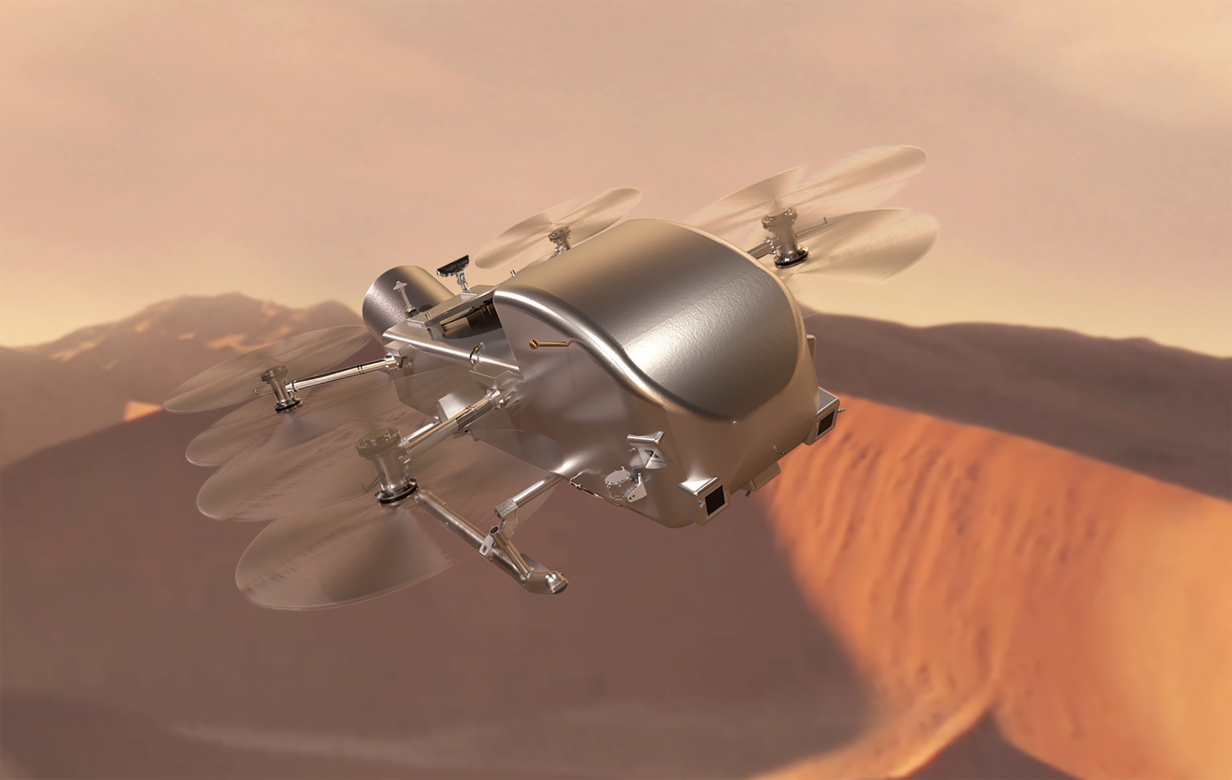 3 min read NASA’s Dragonfly Rotorcraft Mission to Saturn’s Moon Titan Confirmed NASA has confirmed its Dragonfly rotorcraft mission to Saturn’s organic-rich moon Titan. The decision allows…
Article 20 hours ago
Keep Exploring Discover Related Topics Earth Observations
 Technology Transfer & Spinoffs