
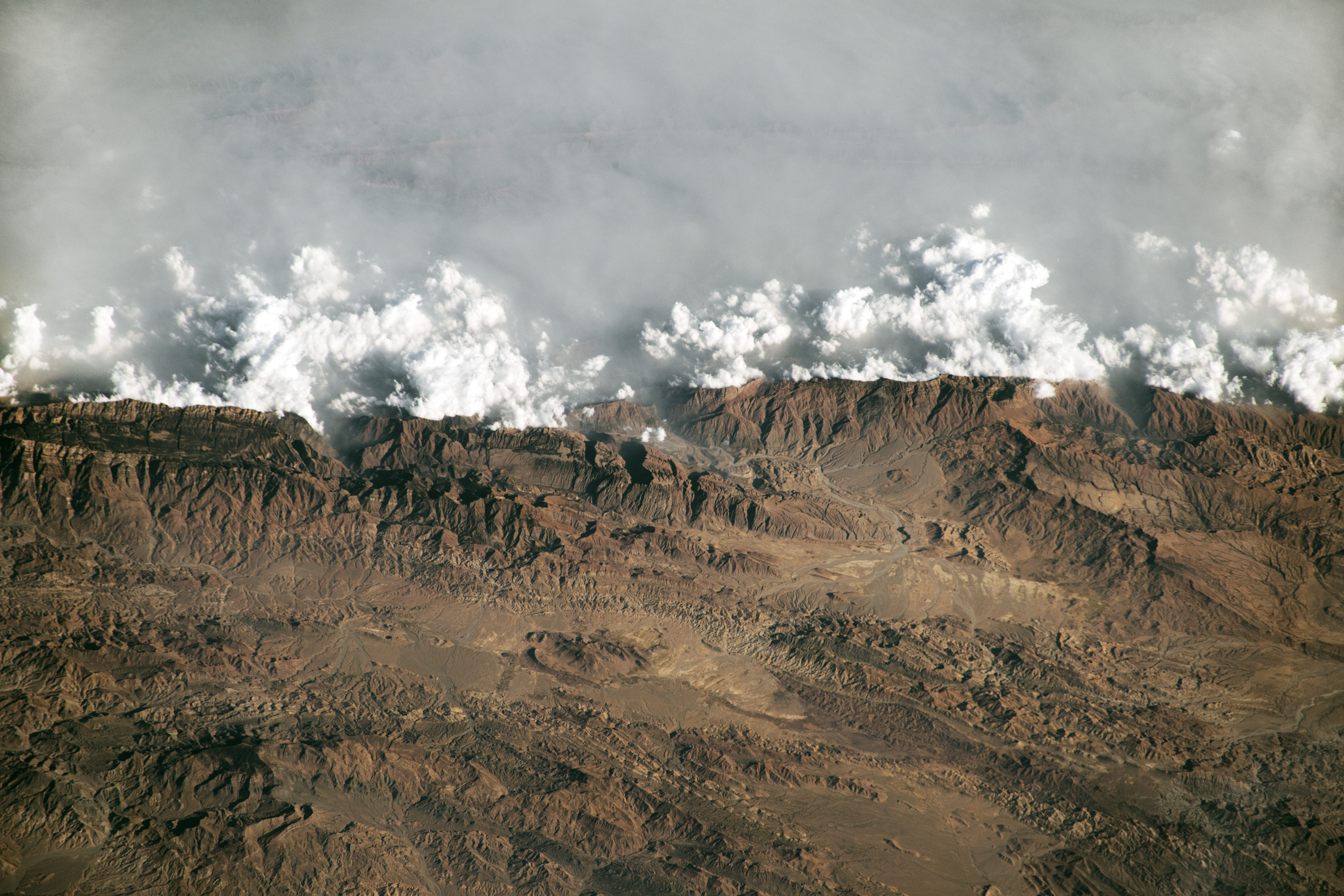
 An astronaut aboard the International Space Station took this oblique photograph of the Sulaiman Mountains in central Pakistan. The range resulted from the slow-motion collision of the Indian and Eurasian tectonic plates that began about 60 million years ago. Peaks rise to more than 3,000 meters (10,000 feet) above sea level in the northern portion of the mountain range, shown in this photograph.NASA An astronaut aboard the International Space Station took this Dec. 17, 2023, photograph of the Sulaiman Mountains in central Pakistan. The Sulaiman Mountains form a natural barrier between the plateaus to the west and the Indus River Valley to the east. Winds blowing from the Indian Ocean and Indus floodplain carry moisture and particulates inland, causing a combination of haze, mist, and clouds to form on the windward side of the mountain range.
A unique attribute of astronaut photography of Earth is the crew member’s ability to highlight features of the landscape by taking photos from perspectives other than straight-down (nadir). This photo leverages an oblique view to highlight the ruggedness of the Sulaiman Mountains by accentuating shadows created by the topography.
To celebrate its 25th anniversary, NASA Earth Observatory (EO) has gathered 25 of their favorite images and data visualizations. Since EO’s launch on April 29, 1999, the site has hosted more than 18,000 image-driven stories, featuring everything from the newest satellite imagery to decades-long records of change.
Text Credit: Cadan Cummings
Image Credit: NASA