Curiosity Navigation Curiosity Home Mission Overview Where is Curiosity? Mission Updates Science Overview Instruments Highlights Exploration Goals News and Features Multimedia Curiosity Raw Images Images Videos Audio More Resources Mars Missions Mars Sample Return Mars Perseverance Rover Mars Curiosity Rover MAVEN Mars Reconnaissance Orbiter Mars Odyssey More Mars Missions The Solar System The Sun Mercury Venus Earth The Moon Mars Jupiter Saturn Uranus Neptune Pluto & Dwarf Planets Asteroids, Comets & Meteors The Kuiper Belt The Oort Cloud 4 min read
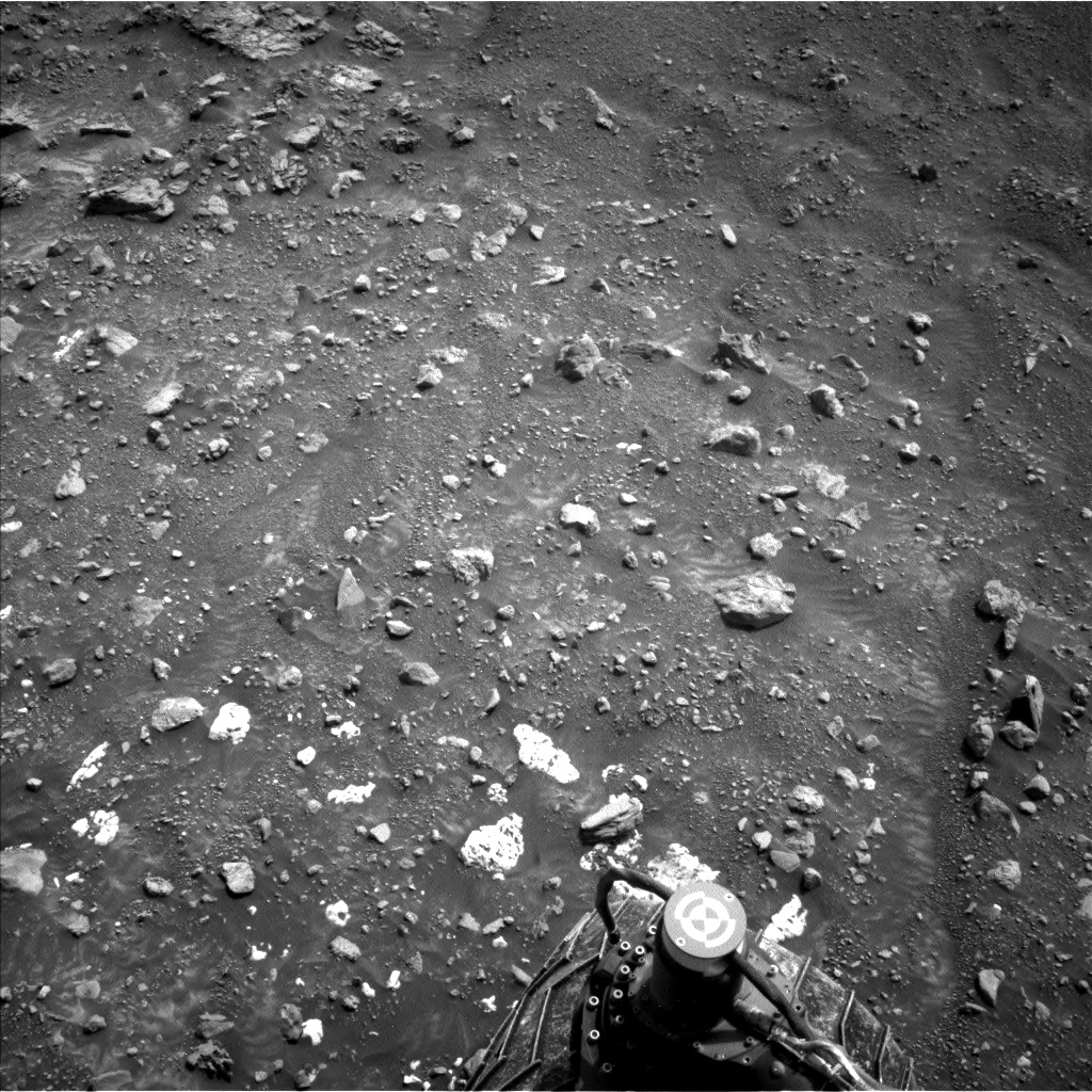
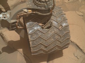
Sols 4316-4317: Hunting for Sulfur  This image was taken by the Left Navigation Camera (NavCam) aboard NASA’s Mars rover Curiosity, and captures the bright stones of the “Sheep Creek” target — just above the rover wheel – which strongly resemble elemental sulfur blocks identified earlier in the traverse. This image was taken on sol 4314, Martian day 4,314 of the Mars Science Laboratory mission, on Sept. 24, 2024, at 20:24:50 UTC. NASA/JPL-Caltech Earth planning date: Wednesday, Sept. 25, 2024
Navigating the rugged, unforgiving Martian terrain is always a challenge, and our recent attempt to reach the “Sheep Creek” target highlights this. We had aimed for small, distant bright rocks, but from 50 meters away (about 164 feet), the limited resolution of our images made it difficult to fine-tune navigation. After an ambitious drive, the rover came agonizingly close — stopping just short of these small bright rocks. The rocks, with their distinctive rounded and pitted “weathering” pattern (pictured), strongly resemble elemental sulfur blocks that we’ve encountered before. Frustratingly, although the target rocks were right under the front wheel and clearly visible in our navigation cameras, they remained just out of reach of the rover’s arm.
While the rover’s arm couldn’t quite reach the bright stones of Sheep Creek, we didn’t let that stop us and planned to use other onboard instruments to help us analyze the composition, textures, and context before we move to our next position. As the Keeper of the Plan for the Geology and Mineralogy theme group, my role was to ensure all those activities were recorded in the plan.
To find out the composition of the stones of Sheep Creek, we used ChemCam (our onboard laser) to observe two promising stones we’ve named “Arch Rock” and “Ash Mountain.” We’re hoping to see if they have any evidence of elemental sulfur as their appearance suggests. For a closer look at the texture, we will take high-resolution, color images with Mastcam (which you can also view in 3D with red and blue anaglyph glasses!). We also want to look at an interesting transition between light-colored and dark-colored bedrock nearby, which we will cover with more high-resolution, colored images. This transition could give us clues about where the unusual white rocks of Sheep Creek came from and how they formed.
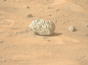
We had our eye on another bright rock in the area, named “Beryl Lake.” It had an interesting bright-toned crusty appearance and as we could reach it with the rover arm, we used our APXS tool (think of it as a chemical scanner) to see its composition and if it had any traces of sulfur. We took a closer look with our rover hand lens (MAHLI) at a rock called “Aster Lake,” which had intriguing white patches that might be similar to the stones of Sheep Creek. Ultimately, our science goal this plan was to collect data on whether these bright-toned stones had evidence of elemental sulfur and increase our understanding on how they formed.
Next, we’ll carefully reposition the rover to move closer to these interesting targets — a maneuver that we call a “bump” — so that next plan, set to occur over the weekend, we’ll be able to get up close and personal with the white stones of Sheep Creek. While the rover waits for the weekend plan, we’re setting up the rover to do some “untargeted” science after the drive. This includes using an automated tool called AEGIS that finds interesting targets on its own and zaps them with the ChemCam laser. Plus, it’s a good time to record some observations of the modern Martian environment, so we’ll make the most of the time to measure dust levels, take movies that will hopefully capture some dust devils, and look at clouds — if any — in the Martian sky.
We’re looking forward to the weekend plan to hopefully get another chance to do some contact science on targets that may be rich in sulfur!
Written by Amelie Roberts, Ph.D. Candidate at Imperial College London
Details Last Updated Sep 27, 2024 Related Terms Blogs
 3 min read Sols 4314-4315: Wait, What Was That Back There?
Article
3 days ago
 3 min read A Striped Surprise Last week, team scientists and the internet alike were amazed when Perseverance spotted a black-and-white…
Article
4 days ago
 3 min read Sols 4311–4313: A Weekend of Engineering Curiosity
Article
4 days ago
Keep Exploring Discover More Topics From NASA Mars
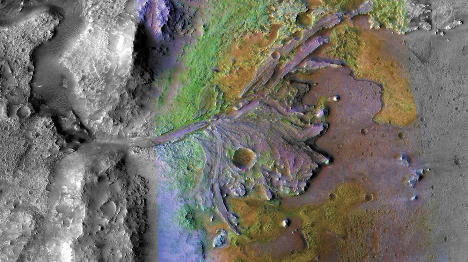
Mars is the fourth planet from the Sun, and the seventh largest. It’s the only planet we know of inhabited…

Explore this collection of Mars images, videos, resources, PDFs, and toolkits. Discover valuable content designed to inform, educate, and inspire,…
Each robotic explorer sent to the Red Planet has its own unique capabilities driven by science. Many attributes of a…

Mars Exploration: Science Goals
The key to understanding the past, present or future potential for life on Mars can be found in NASA’s four…