Curiosity Navigation Curiosity Home Mission Overview Where is Curiosity? Mission Updates Science Overview Instruments Highlights Exploration Goals News and Features Multimedia Curiosity Raw Images Images Videos Audio More Resources Mars Missions Mars Sample Return Mars Perseverance Rover Mars Curiosity Rover MAVEN Mars Reconnaissance Orbiter Mars Odyssey More Mars Missions The Solar System The Sun Mercury Venus Earth The Moon Mars Jupiter Saturn Uranus Neptune Pluto & Dwarf Planets Asteroids, Comets & Meteors The Kuiper Belt The Oort Cloud 4 min read
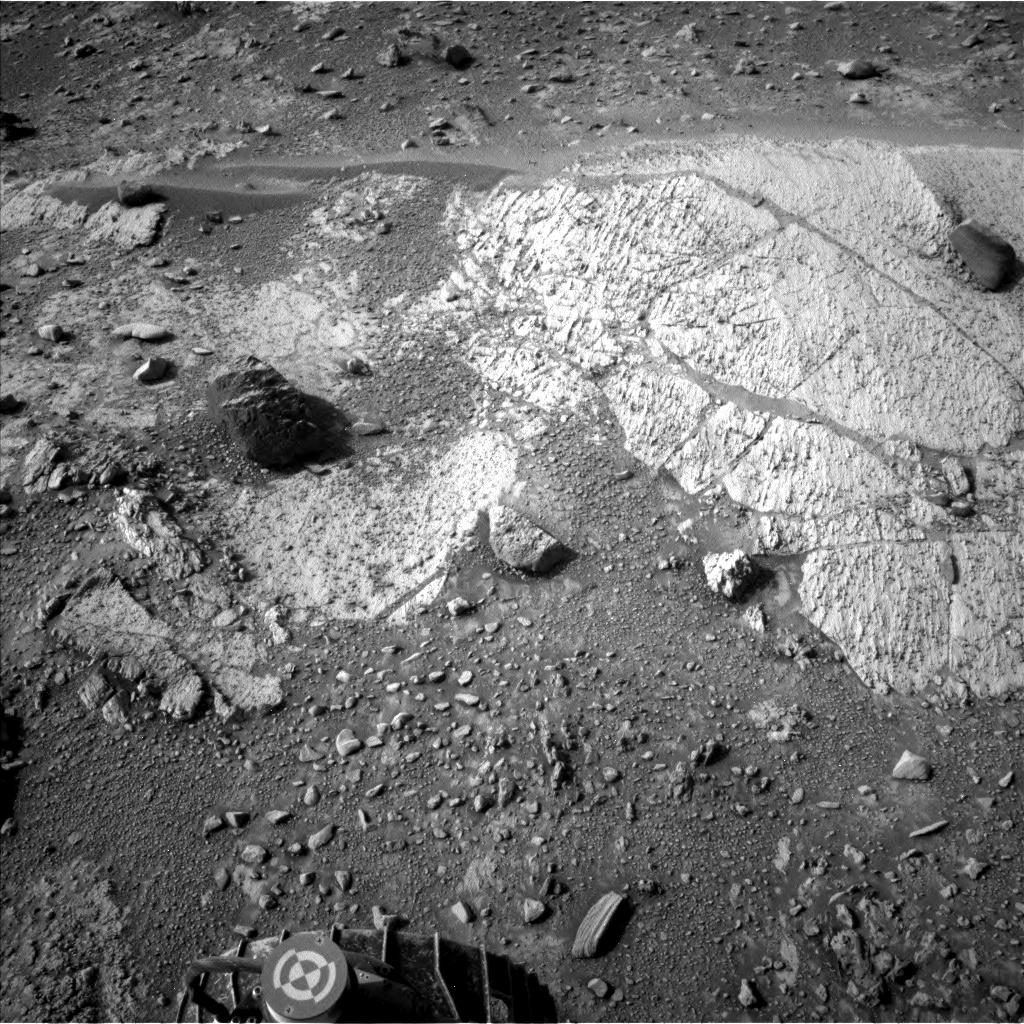
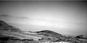
Sols 4284–4286: Environmental Science Extravaganza  This image was taken by Left Navigation Camera onboard NASA’s Mars rover Curiosity on Sol 4282 (2024-08-22 23:39:35 UTC). NASA/JPL-Caltech Earth planning date: Friday, Aug. 23, 2024
One of the many challenges of operating a rover on another planet is that we don’t always know where we’re going to be located before planning starts each day. Although we do plan our drives in advance, Curiosity doesn’t blindly follow the orders that we deliver. If an unsafe situation is detected, such as if the wheels slip too much in the sand or if the rover tries to drive along too steep of a slope, it will end the drive early and wait for us back on Earth to assess the situation. Although we prefer for the rover to end up parked exactly where we told it to, safety is always the first priority.
Coming into planning today, it looked like it was going to be smooth riding. Before planning began, we received an email from our localization team informing us that Monday’s short drive away from Kings Canyon appeared to have completed successfully, so everyone was ready to start poking around in our new workspace. It wasn’t long before we realized that we were facing a bit of an unusual situation. Although the drive completed, we were missing almost all of our post-drive imaging. When a drive completes, we take a set of Navcam, Mastcam, and Hazcam images of our new location that we then use to determine the targets that we want to perform contact science and remote sensing on and to plan our drives. Without those images, there are very few activities that we can plan. Fortunately, we did receive one Navcam image near our new workspace (which you can see in the cover image above), so the geology and mineralogy (GEO) team had something to work with, though their ability to select targets was still severely limited.
For me, on the environmental science (ENV) team, this was great news. Almost all of our observations are completely untargeted, so we don’t really care where exactly the rover is located. As such, we were given an opportunity to make lemonade out of the lemons that the mission was handed today. In a reversal from our usual roles, GEO planned out their limited set of activities then passed the rest of the science time over to ENV. This was particularly exciting given that, as was noted on Wednesday, we’ve initiated a dust storm watch. The dust storm developing on the other side of Mars is likely the annual “C” storm. The last time a dust storm went global this late in the year was during the Viking era, so we expect that this storm will stay regional rather than becoming global. Still, because global dust storms happen so infrequently, we’ve initiated a storm watch so that we’re ready just in case the unexpected happens.
Although GEO’s activities are limited in this plan, the team did the best with what little data they had available. These activities include ChemCam LIBS and Mastcam observations of “Lembert Dome” (some nodular light-toned bedrock), “Wilts Col” (a dark-toned float block that we got ChemCam passive spectra of back on sol 4259), and “Return Creek” (another float block). We’re also taking ChemCam passive spectra and Mastcam images of a dark-toned float block “Matlock Lake.” In preparation for planning on Monday, we’re also taking a Mastcam survey of the workspace. Because we had to pull our arm activities and the drive we had planned, the CheMin team was also able to fit in an empty cell analysis activity that they had been looking for time to execute.
ENV’s activities are nothing unusual, but they are numerous. We were able to fit in about three-and-a-half hours of dust devil movies over these three sols, as well as about an hour-and-a-half of cloud movies, including some shortly before sunset when we rarely are able to take movies. In addition, we have a handful of Navcam line-of-sight and Mastcam tau observations to monitor the developing dust storm.
In classic just-too-late form, the missing data finally appeared right as we were finalizing the plan. Not of any use to us today (though the views from our new location are as stunning as ever), but we’re set up for a return to normal operations on Monday.
Written by Conor Hayes, Graduate Student at York University
Details Last Updated Aug 26, 2024 Related Terms Blogs
Keep Exploring Discover More Topics From NASA Mars
Mars is the fourth planet from the Sun, and the seventh largest. It’s the only planet we know of inhabited…

Explore this collection of Mars images, videos, resources, PDFs, and toolkits. Discover valuable content designed to inform, educate, and inspire,…
Each robotic explorer sent to the Red Planet has its own unique capabilities driven by science. Many attributes of a…

Mars Exploration: Science Goals
The key to understanding the past, present or future potential for life on Mars can be found in NASA’s four…

 3 min read Sols 4282-4283: Bumping Away from Kings Canyon
 2 min read Sols 4280-4281: Last Call at Kings Canyon
 4 min read Sols 4277-4279: Getting Ready To Say Goodbye to the King!
