3 min read
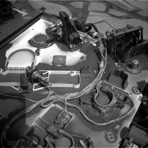
Sols 4159-4160: A Fully Loaded First Sol 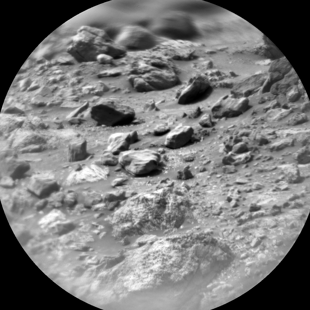 This image was taken by Chemistry & Camera (ChemCam) onboard NASA’s Mars rover Curiosity on Sol 4158 (2024-04-17 07:52:27 UTC). NASA/JPL-Caltech/LANL Earth planning date: Wednesday, April 17, 2024
Curiosity continues to make progress along the margin of upper Gediz Vallis ridge, investigating the broken bedrock in our workspace and acquiring images of the ridge deposit as the rover drives south.
Today’s 2-sol plan focused on a DRT, contact science, and drive on the first sol, followed by untargeted remote sensing on the second sol. The team had to make some decisions at the start of planning about whether to drive on the first or second sol of this plan, and how that would affect the upcoming weekend activities. As it turned out, the team was able to fit all of the desired contact science and remote sensing activities on the first sol, in addition to the drive on the first sol, which means we’ll be able to downlink more information about our end-of-drive location to better inform planning for the weekend. Weekend plans provide opportunities for a lot of great contact science, so it will be really helpful to have that additional data down for planning.
That means the first sol of this plan is fully loaded! The plan begins with a DRT activity to expose a fresh surface on the bedrock target “Tilden Lake,” followed by APXS integrations to investigate its composition. Then the Geology theme group planned several hours of remote sensing activities, including ChemCam LIBS on the bedrock target “Curry Village,” which has a similar “dragon scale” texture (or “tire tracks”) to what we had observed in the previous workspace. This big remote sensing block also includes ChemCam long distance RMI mosaics to assess the stratigraphy at Gediz Vallis ridge and the distant butte Kukenan. These long distance RMI images reveal a lot of great detail about distant targets, like the diversity of clasts at Gediz Vallis ridge, as seen in the above image.
The plan also includes a number of Mastcam activities to characterize local textures, sedimentary structures, dark rocks, and sandy aeolian bedforms (known as Transverse Aeolian Ridges, aka TARs) in a nearby trough. The Environmental theme group also planned activities to monitor the movement of fines on the rover deck, search for dust devils, and monitor atmospheric dust. After this big remote sensing block, Curiosity will use MAHLI to image the contact science target, and then continue driving south. The second sol includes untargeted activities like an autonomously selected ChemCam AEGIS target, additional Navcam deck monitoring, and Navcam line-of-sight observations. After the drive we’ll take post drive imaging to prepare for the next plan.
Looking forward to seeing what other surprises our next workspace will reveal!
Written by Lauren Edgar, Planetary Geologist at USGS Astrogeology Science Center
Details Last Updated Apr 18, 2024 Related Terms Blogs Curiosity (Rover) Mars Mars Science Laboratory (MSL)
 3 min read Comet Geyser: Perseverance’s 21st Rock Core
Article
2 days ago
 3 min read Sols 4157-4158: What is That??
Article
3 days ago
 5 min read Sols 4154-4156: Bumpy Driving up the Mountain
Article
6 days ago
Keep Exploring Discover More Topics From NASA Mars
Mars is no place for the faint-hearted. It’s dry, rocky, and bitter cold. The fourth planet from the Sun, Mars…

Mars Exploration Science Goals