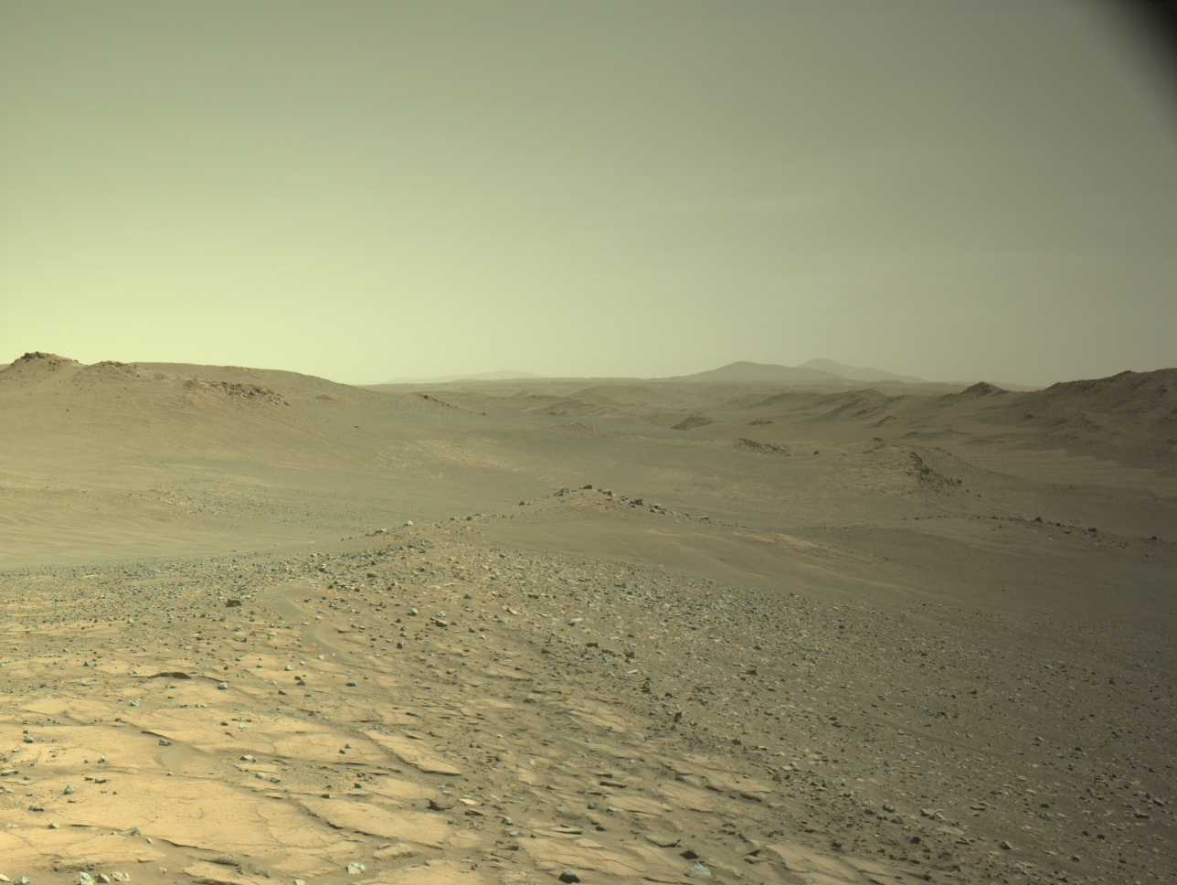
Explore This Section Perseverance Home Mission Overview Rover Components Mars Rock Samples Where is Perseverance? Ingenuity Mars Helicopter Mission Updates Science Overview Objectives Instruments Highlights Exploration Goals News and Features Multimedia Perseverance Raw Images Images Videos Audio More Resources Mars Missions Mars Sample Return Mars Perseverance Rover Mars Curiosity Rover MAVEN Mars Reconnaissance Orbiter Mars Odyssey More Mars Missions Mars Home  This image was taken when Perseverance topped Soroya ridge. Using the Left Navigation Camera (Navcam), the image was acquired on Aug. 17, 2025 (Sol 1597) at the local mean solar time of 13:54:37. NASA/JPL-Caltech Written by Eleanor Moreland, Ph.D. Student Collaborator at Rice University
Perseverance has continued exploring beyond the rim of Jezero crater, spending time last week at Parnasset conducting a mini-campaign on aeolian bedforms. After wrapping up that work, three separate drives brought Perseverance further southeast to an outcrop named Soroya.
Soroya was first picked out from orbital images as a target of interest because, as can be seen in the above image, it appears as a much lighter color compared to the surroundings. In previous landscape images from the surface, Mars 2020 scientists have been able to pick out the light-toned Soryoa outcrop, and they noted it forms a ridge-like structure, protruding above the surface. Soroya was easily identifiable from rover images (below) as Perseverance approached since it indeed rises above the surrounding low-lying terrain.
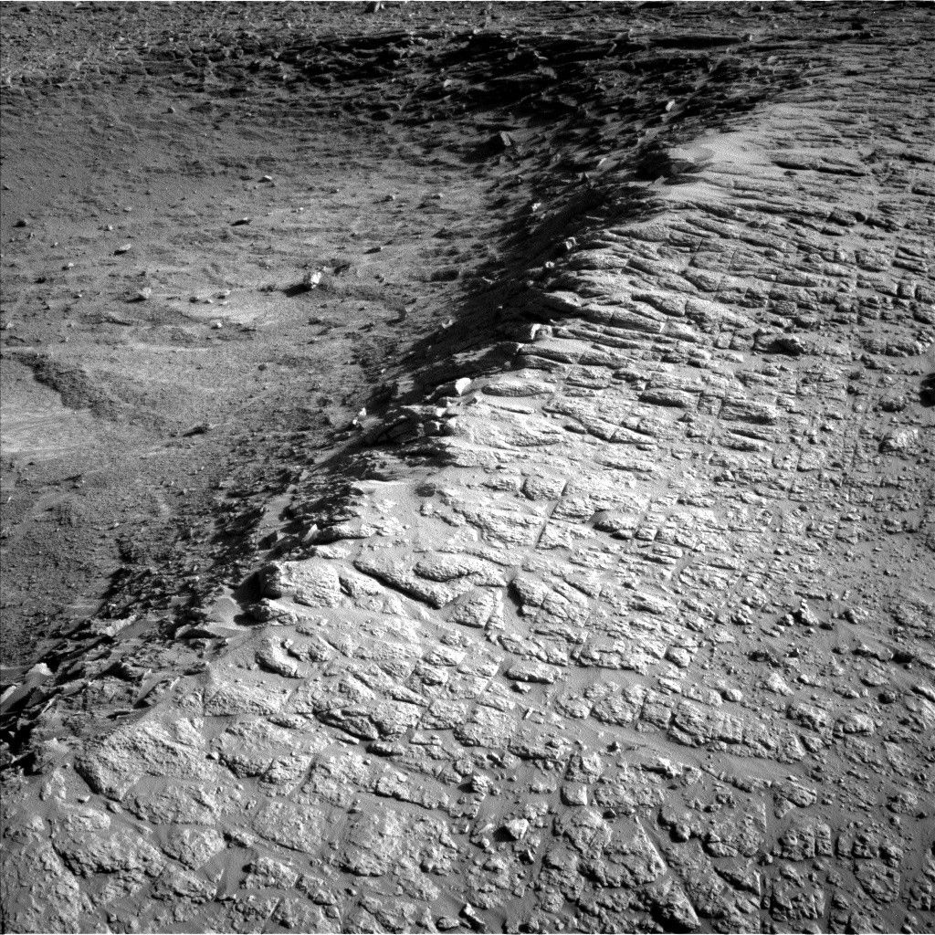
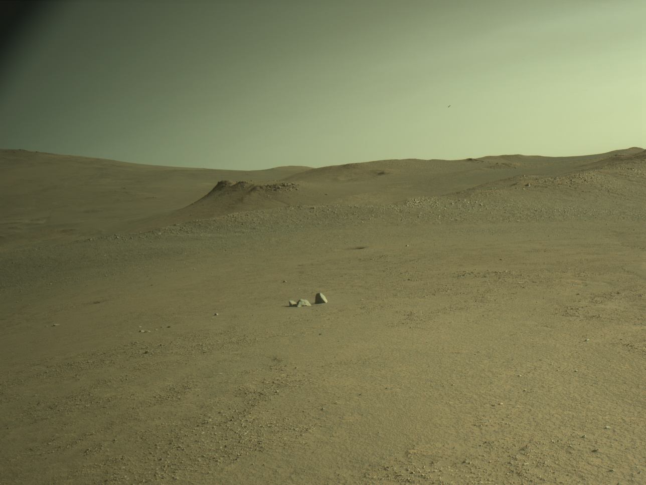 The Perseverance rover acquired this image looking at Soroya using the onboard Left Navigation Camera (Navcam). This image was acquired on Aug. 15, 2025 (Sol 1595) at the local mean solar time of 16:34:53. NASA/JPL-Caltech From Parnasset to Soroya, the team planned a series of drives so that Perseverance would arrive at Soroya in a great workspace, and the plan was successful. As shown in the first image, we arrived at an area with flat, exposed bedrock – great for proximity science instruments.
The WATSON and SHERLOC ACI cameras plan to acquire many high-resolution images to investigate textures and surface features. For chemistry, SCAM LIBS and ZCAM multispectral activities will give important contextual data for the outcrop while PIXL will acquire a high-resolution chemical map scan of a dust-cleared part of the bedrock. While parked, MEDA will continue monitoring environmental conditions and ZCAM will image the surrounding terrain to inform the next drive location. Take a look at where Perseverance is now – where would you explore next?
Want to read more posts from the Perseverance team?
Visit Mission Updates
Want to learn more about Perseverance’s science instruments?
Visit the Science Instruments page

Details Last Updated Aug 27, 2025 Related Terms Blogs
 3 min read Curiosity Blog, Sols 4638-4640: Imaging Extravaganza Atop a Ridge
Article
2 days ago
 3 min read To See the World in a Grain of Sand: Investigating Megaripples at ‘Kerrlaguna’
Article
6 days ago
 2 min read Curiosity Blog, Sols 4636-4637: Up Against a Wall
Article
7 days ago
Keep Exploring Discover More Topics From NASA Current Mars Investigations
Current Mars Investigations The weather and climate of Mars are controlled by the coupled seasonal cycles of CO2, dust, and…
Explore this collection of Mars images, videos, resources, PDFs, and toolkits. Discover valuable content designed to inform, educate, and inspire,…

Each robotic explorer sent to the Red Planet has its own unique capabilities driven by science. Many attributes of a…

Mars Exploration: Science Goals
The key to understanding the past, present or future potential for life on Mars can be found in NASA’s four…

