
4 min read
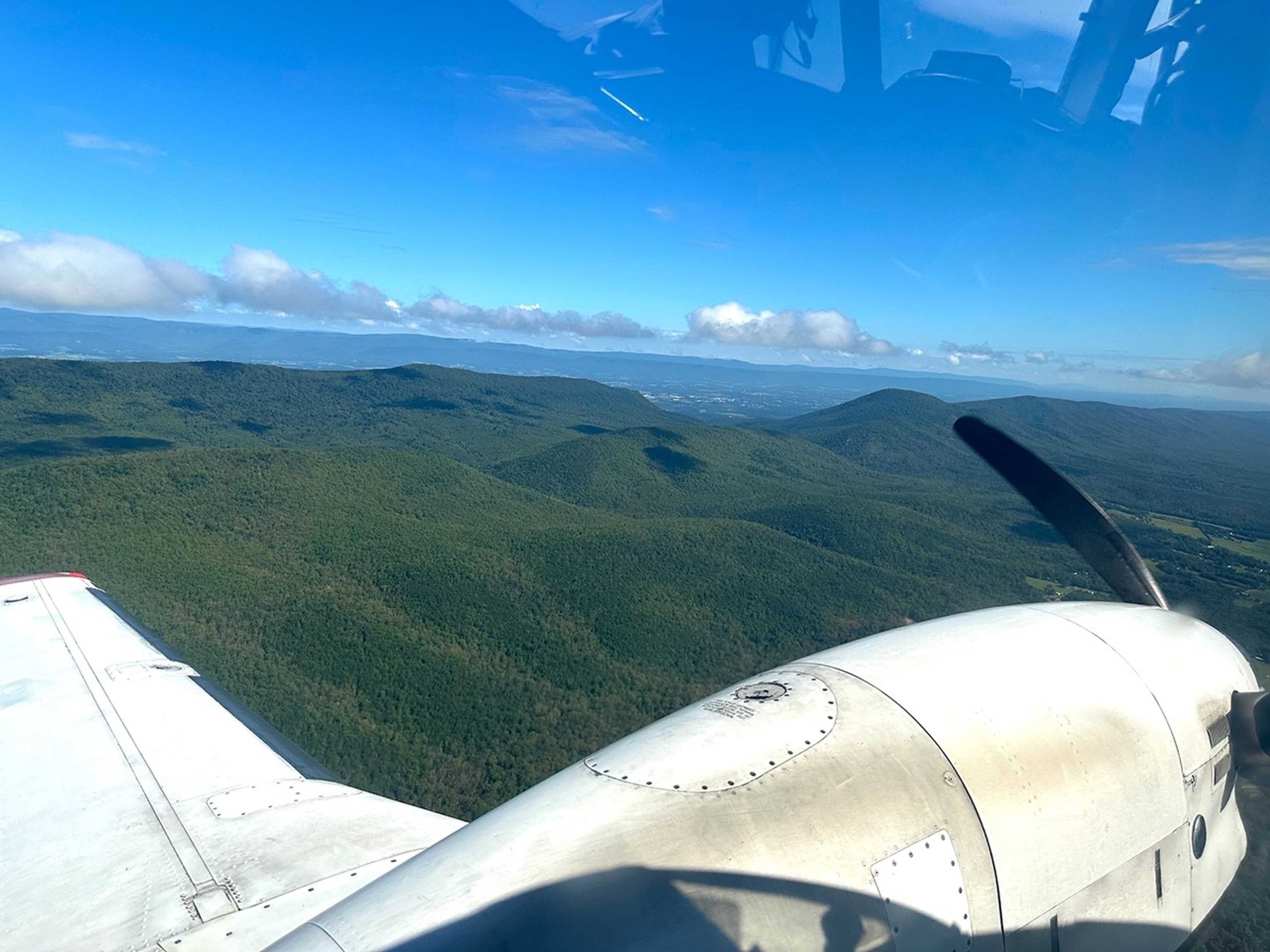
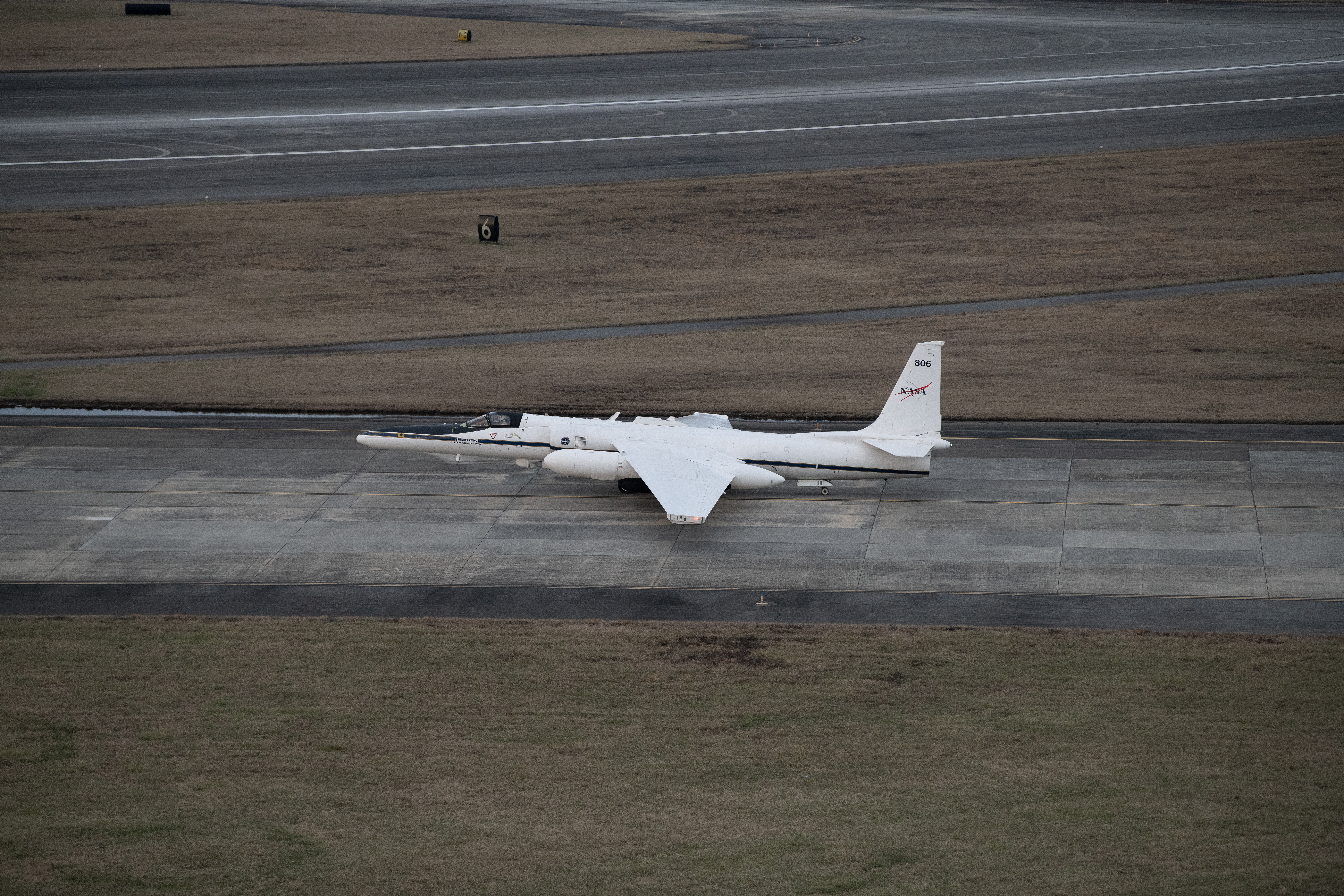
NASA Aircraft Coordinate Science Flights to Measure Air Quality 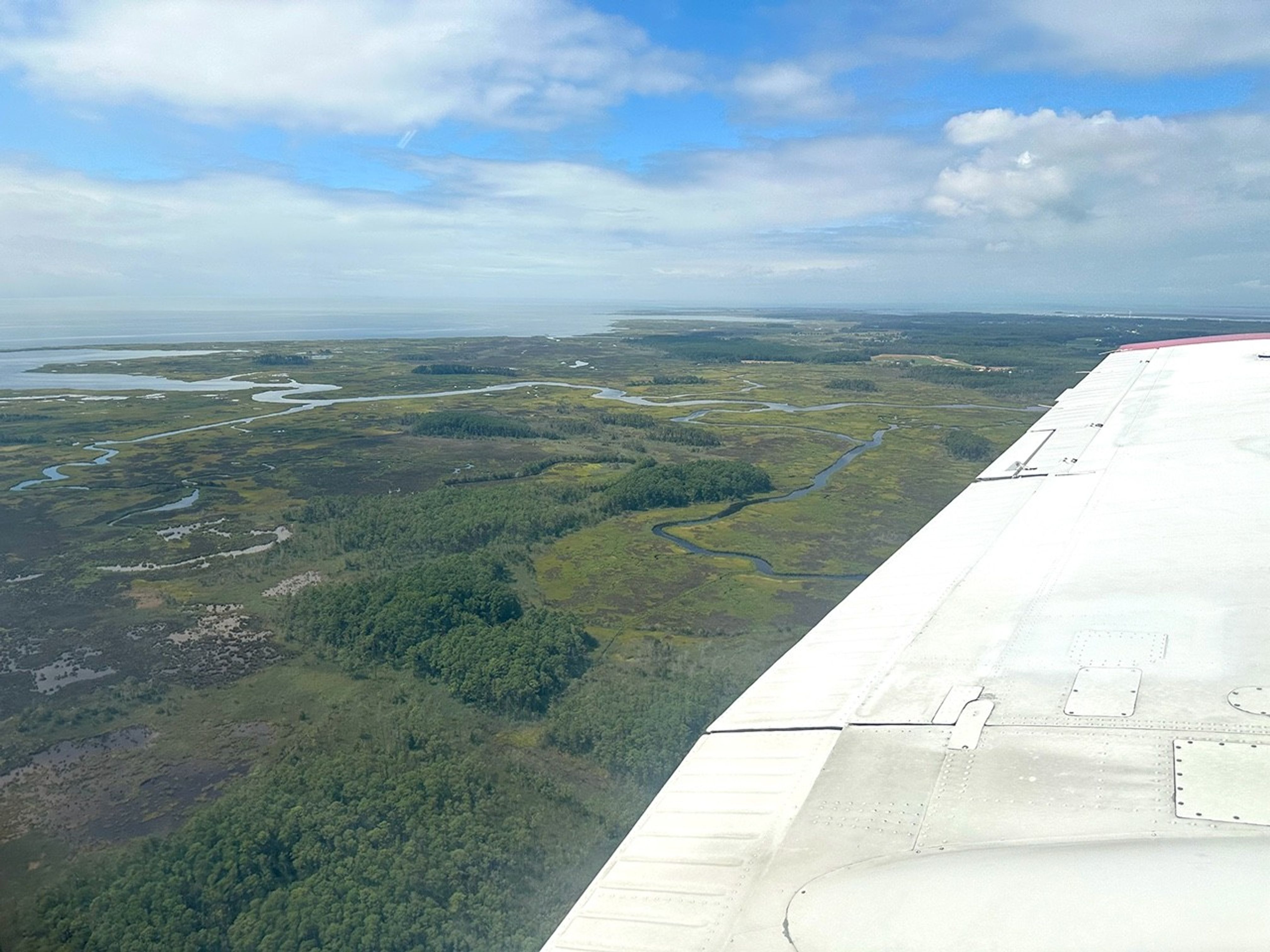 NASA Goddard’s G-LiHT flying on the A90 flies over Shenandoah Valley in the US East Coast during the week of August 11-15. Credit: NASA/Shawn Serbin Magic is in the air. No wait… MAGEQ is in the air, featuring scientists from NASA centers across the country who teamed up with the National Oceanic and Atmospheric Administration (NOAA), the University of Maryland Baltimore County, and several other university and government partners and collaborators.
This summer, six planes collectively flew more than 400 hours over the mid-Atlantic United States with a goal of gathering data on a range of objectives, including air quality, forestry, and fire management.
This was part of an effort called MAGEQ, short for Mid-Atlantic Gas Emissions Quantification. Rather than one mission, MAGEQ consists of several individual missions across more than a dozen organizations and agencies, along with university students. Over the course of around six weeks, aircraft flew over cities, wetlands, farms, and coal mining areas.
 NASA Goddard’s G-LiHT flying on the A90 flies over the Chesapeake Bay near the Big Annemessex River. Credit: NASA/Shawn Serbin “Each aircraft team is comprised of highly skilled and motivated people who understand how to fly their particular plane to achieve the science they want,” said Glenn Wolfe, research scientist at NASA’s Goddard Space Flight Center in Greenbelt, Maryland, and project lead for MAGEQ. “The complexity comes in identifying how each platform can complement or supplement the others.”
Coordinating flights required both advanced planning and flexibility to get the best outcome. Weather proved to be a primary challenge for the team, as members worked around cloudy days, wind, and storms to ensure safe flights.
The six aircraft had different objectives and requirements. For example, some carried instruments that needed to fly high to simulate a satellite’s view of the atmosphere and the Earth’s surface and could not measure through clouds. Others were equipped with instruments that directly measured the air particles and could work under the clouds, provided there was no rain.
Despite weather challenges, flight teams worked together to coordinate as many multi-aircraft flight days as possible, meeting the overall objective of the MAGEQ campaign.
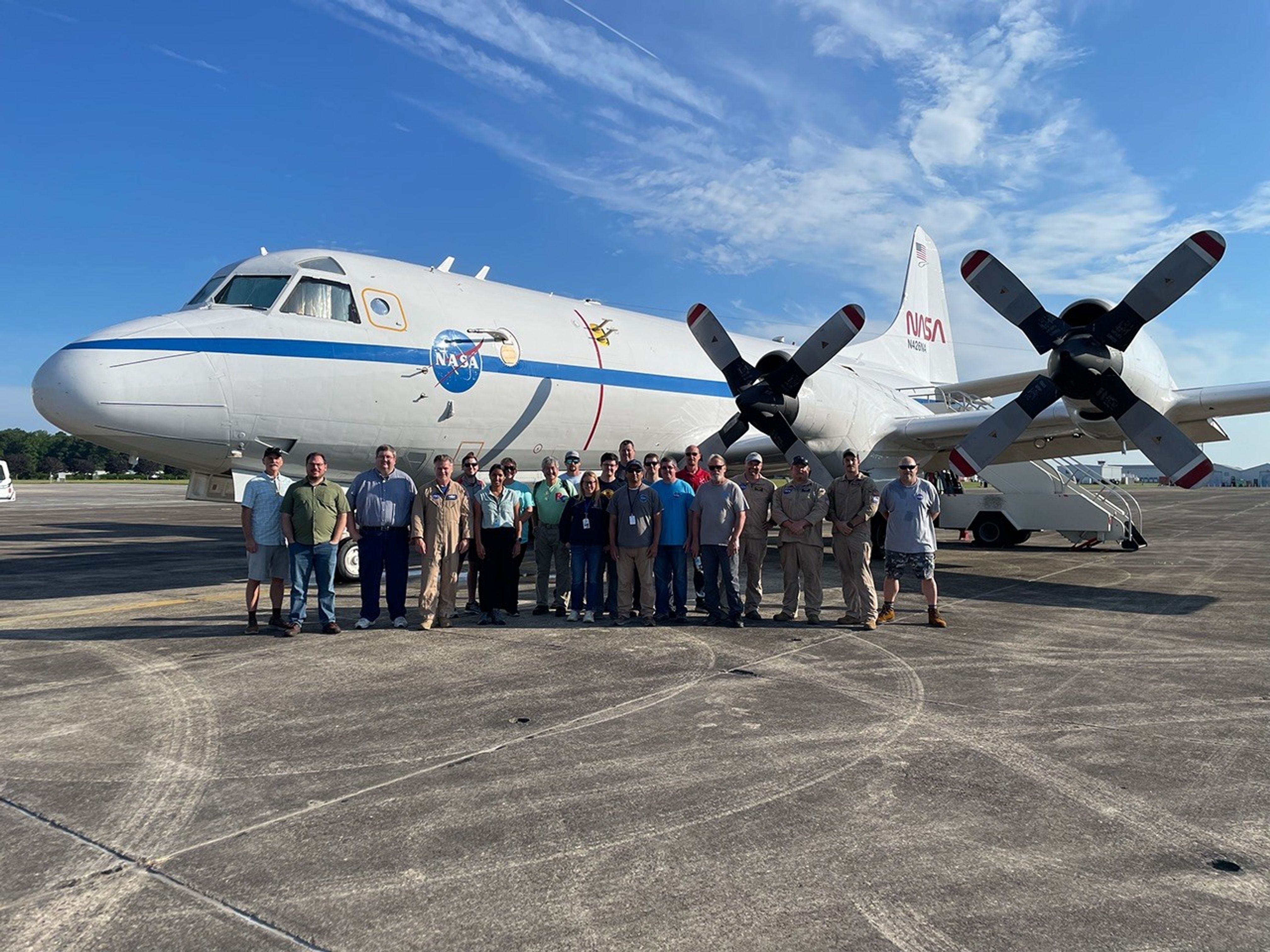 The MAGEQ team members pose in front of the P-3 aircraft at NASA’s Wallops Flight Facility in Virginia.Credit: NASA/Roy Johnson “It’s been inspiring to see how everybody worked together,” said Lesley Ott, research meteorologist and lead carbon cycle modeler for NASA’s Global Modeling and Assimilation Office at NASA Goddard. “By collecting data together, not only can we do a better job as scientists in having more complete understanding, we can also do a better job making usable data sets that meets the needs of different stakeholders.”
State resource managers in North Carolina and Virginia, for example, could benefit from this data as they monitor the health of wetlands, which provide resilience to storms, absorb carbon from the atmosphere and support local tourist industries. The data could also help operators at energy-producing facilities detect methane leaks or equipment failures quickly. Faster detection could speed up intervention and minimize waste, as well as lessen environmental impacts. Stakeholders were an integral part of the planning process, Ott said. They made suggestions about measurement sites and data needs that informed the flight planning.
Scientists will also use the measurements to verify satellite data from both public and commercial data providers. Satellites like the Tropospheric Emissions: Monitoring of Pollution (TEMPO) instrument collect similar data. Scientists can compare the airborne and satellite data to get a more complete picture of the atmosphere. They also will use MAGEQ data to evaluate atmospheric chemistry modeling from the Goddard Earth Observing System (GEOS) model, which connects atmospheric, oceanic, and land data to help create a more comprehensive picture of Earth science.
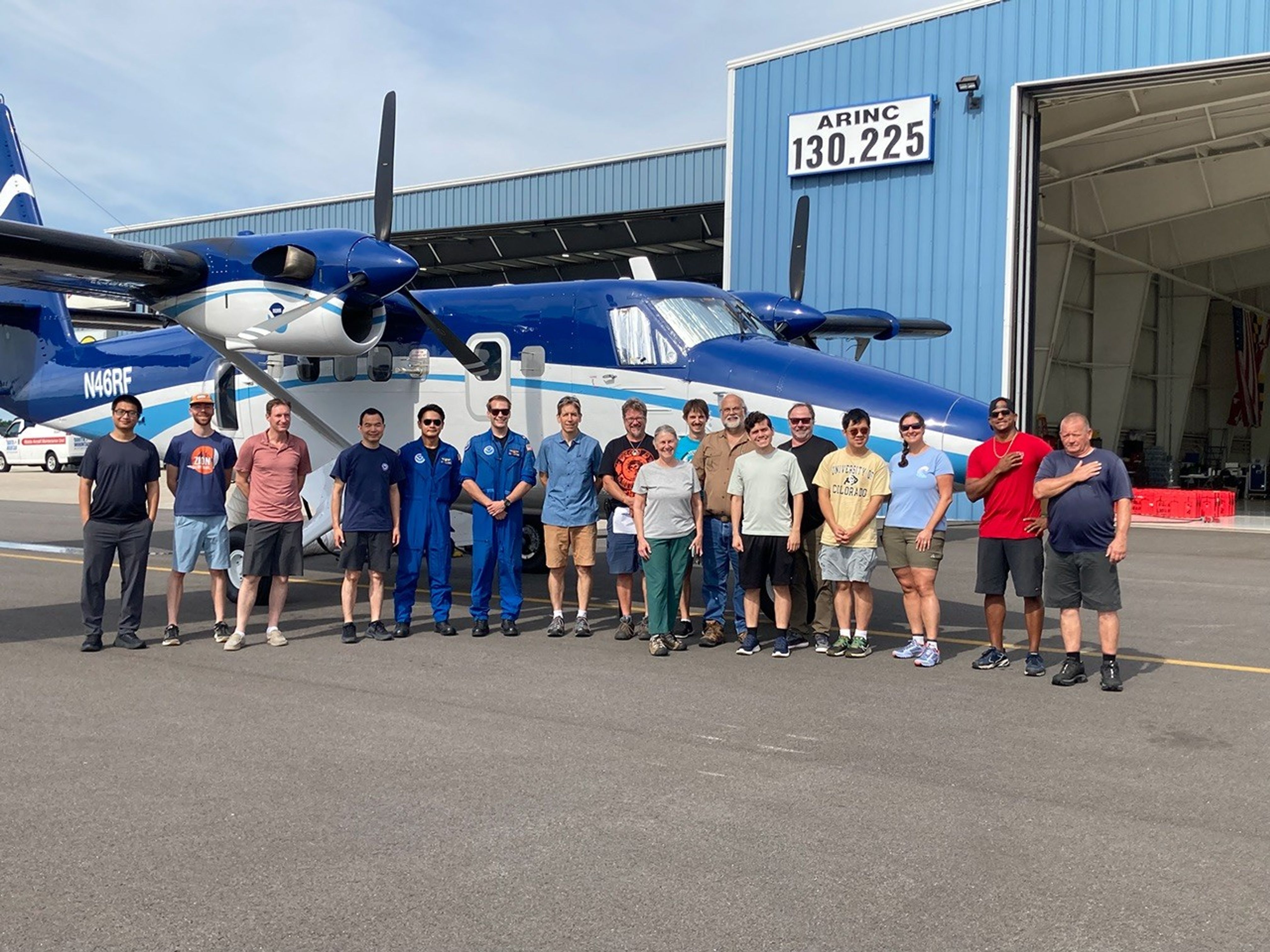 The MAGEQ team members from NOAA and NASA pose in front of the Twin Otter aircraft. Credit: NOAA/Steve Brown “Every aircraft does something different and contributes a different type of data,” said Steve Brown, leader of the tropospheric chemistry and atmospheric remote sensing programs at the NOAA Chemical Sciences Laboratory in Boulder, Colorado. “We’re going to have a lot of work to do at the end of this to put all these data sets together, but we will make the best use of all these measurements.”
NASA’s Goddard Space Flight Center, Greenbelt, Md.
 5 min read NASA Earth Scientists Take Flight, Set Sail to Verify PACE Satellite Data From sea to sky to orbit, a range of vantage points allow NASA Earth scientists…
Article 1 year ago
 2 min read GLOBE-Trotting Science Lands in Chesapeake with NASA eClips Article 2 months ago
  4 min read NASA Mission Monitoring Air Quality from Space Extended Since launching in 2023, NASA’s Tropospheric Emissions: Monitoring of Pollution mission, or TEMPO, has been…
Article 3 months ago
