Earth (ESD) Earth Explore Explore Earth Home Air Quality Climate Change Freshwater Life on Earth Severe Storms Snow and Ice The Global Ocean Science at Work Earth Science at Work Technology and Innovation Powering Business Multimedia Image Collections Videos Data For Researchers About Us 1 min read
From Space to Soil: How NASA Sees Forests NASA uses satellite lidar technology to study Earth’s forests, key carbon sinks. The GEDI mission maps forest height and biomass from the International Space Station, while ICESat-2 fills polar data gaps. Together, they enable a first-of-its-kind global biomass map, guiding smarter forest conservation and carbon tracking.
Details Last Updated Jun 17, 2025 Editor Earth Science Division Editorial Team Related Terms Earth Greenhouse Gases Video Series
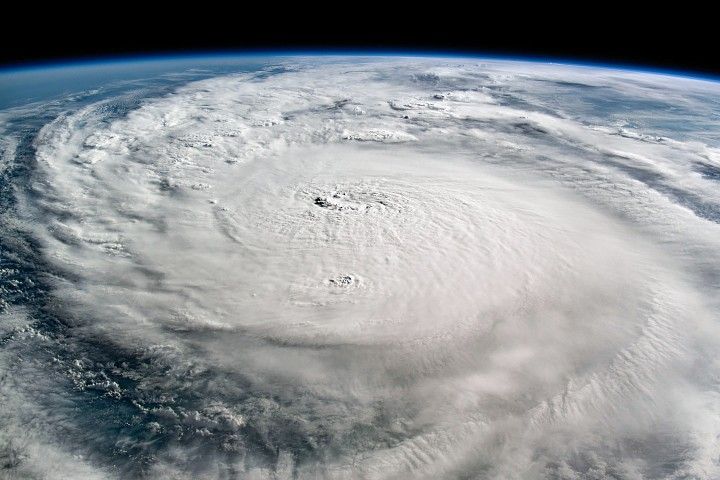
 12 min read NASA’s Hurricane Science, Tech, Data Help American Communities With hurricane season underway, NASA is gearing up to produce cutting-edge research to bolster the…
Article
5 days ago
 1 min read Leaf Year: Seeing Plants in Hyperspectral Color PACE now allows scientists to see three different pigments in vegetation, helping scientists pinpoint even…
Article
2 weeks ago
 6 min read What NASA Is Learning from the Biggest Geomagnetic Storm in 20 Years
Article
1 month ago
Keep Exploring Discover More Topics From NASA Earth
Your home. Our Mission. And the one planet that NASA studies more than any other.


NASA’s unique vantage point helps us inform solutions to enhance decision-making, improve livelihoods, and protect our planet.

NASA is a global leader in studying Earth’s changing climate.