On Feb. 11, 2000, space shuttle Endeavour took to the skies on its 14th trip into space on the Shuttle Radar Topography Mission (SRTM). The international STS-99 crew included Commander Kevin Kregel, Pilot Dominic Gorie, and Mission Specialists Gerhard Thiele of Germany representing the European Space Agency, Janet Kavandi, Janice Voss, who served as payload commander on the mission, and Mamoru Mohri of the National Space Development Agency (NASDA) of Japan, now the Japan Aerospace Exploration Agency.
During their 11-day mission, the astronauts used the radar instruments in Endeavour’s payload bay to obtain elevation data on a near global scale. The data produced the most complete, high-resolution digital elevation model of the Earth. The SRTM comprised a cooperative effort among NASA with the Jet Propulsion Laboratory (JPL) in Pasadena, California, managing the project, the Department of Defense’s National Imagery and Mapping Agency, the German space agency, and the Italian space agency. Prior to SRTM, scientists had a more detailed topographic map of Venus than of the Earth, thanks to the Magellan radar mapping mission.
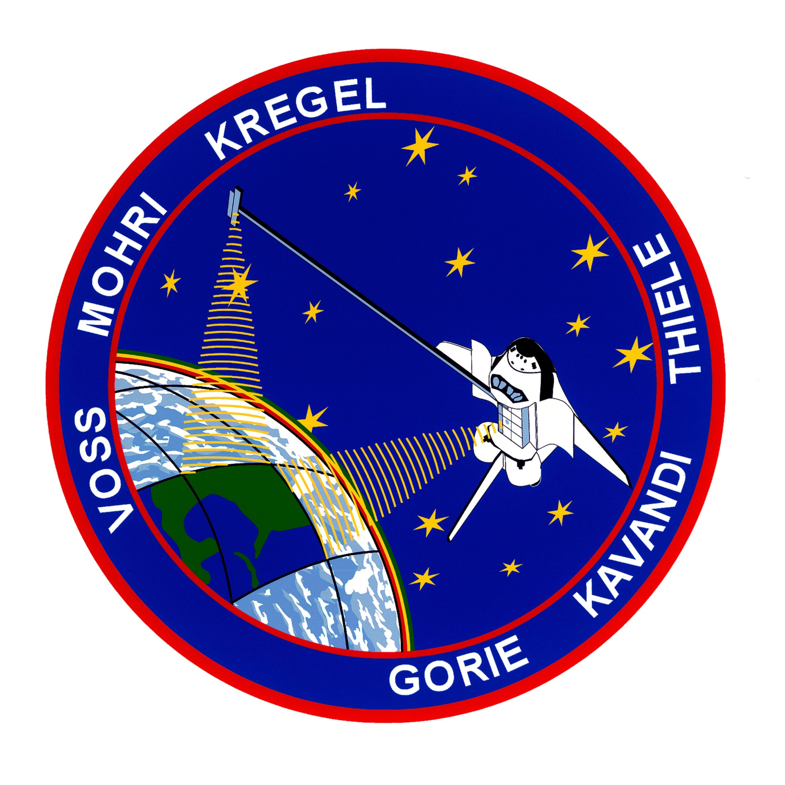
 The STS-99 crew patch.
 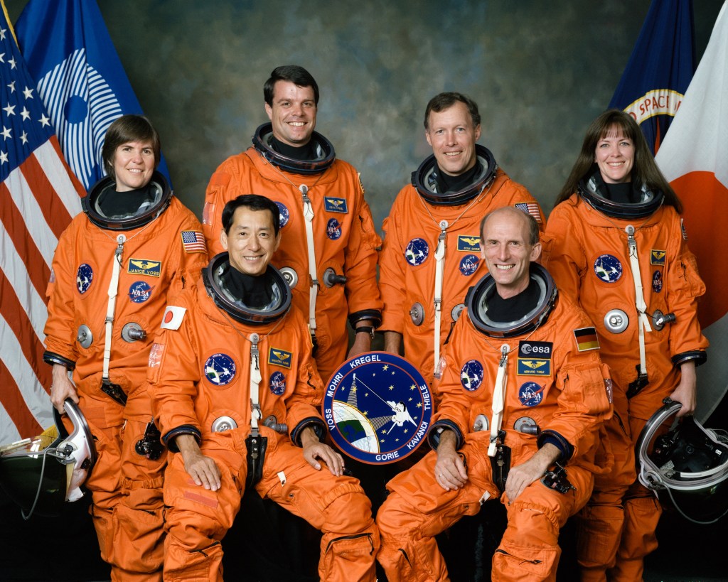 Official photo of the STS-99 crew of Janice Voss, left, Mamoru Mohri of the National Space Development Agency of Japan, now the Japan Aerospace Exploration Agency, Kevin Kregel, Dominic Gorie, Gerhard Thiele of Germany representing the European Space Agency, and Janet Kavandi.
 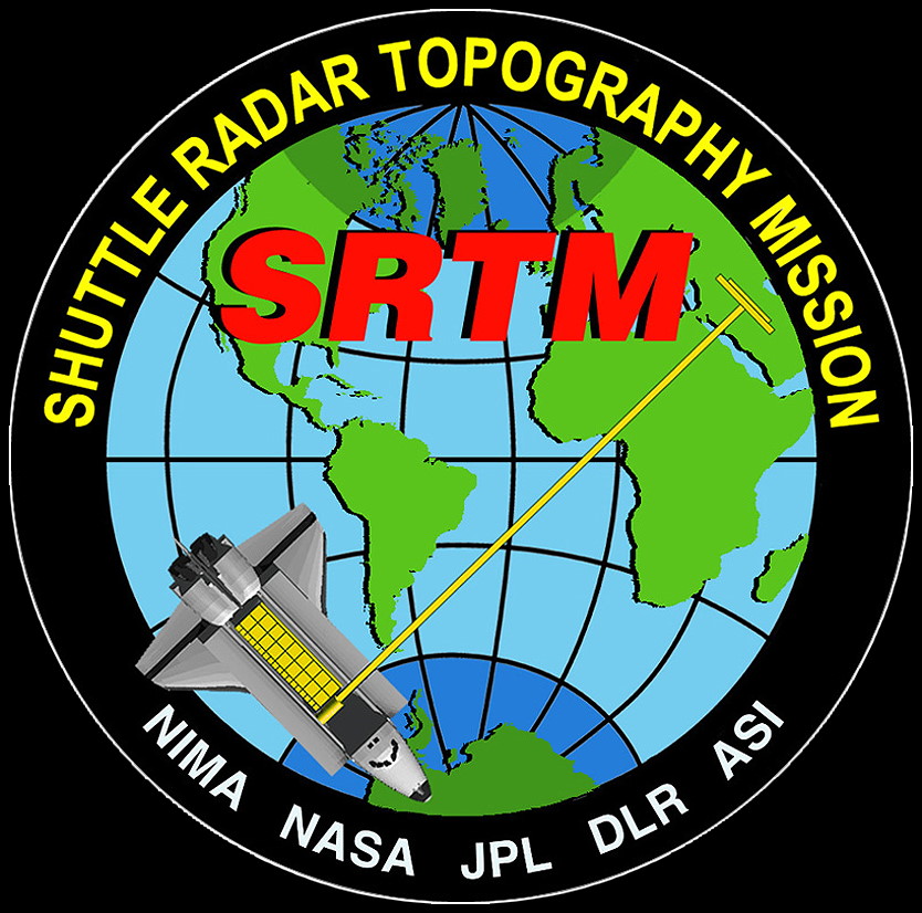 The Shuttle Radar Topography Mission patch.
 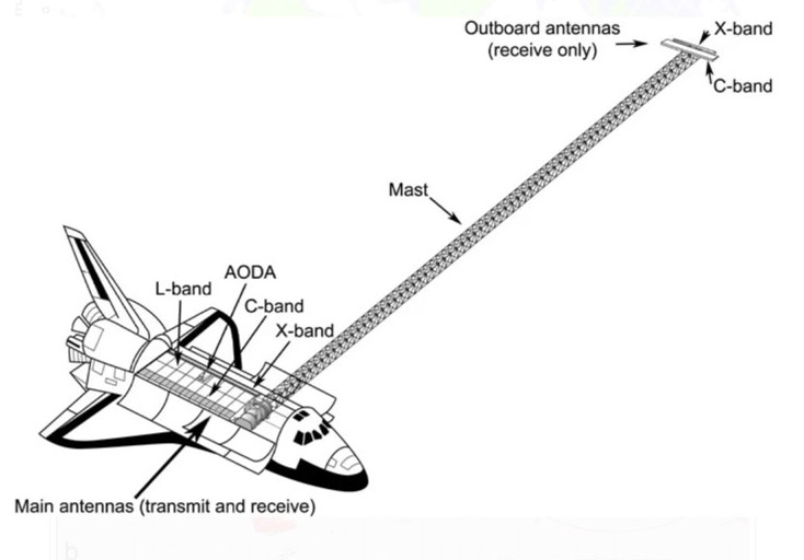 Schematic of the Space Radar Topography Mission payloads including the deployed mast.
 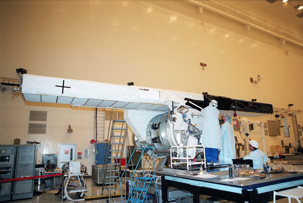 The mast antenna during preflight processing. NASA assigned the STS-99 crew in October 1998. For Kregel, selected by NASA as an astronaut in 1992, STS-99 marked his fourth trip to space, having served as pilot on STS-70 and STS-78 and commanded STS-87. Gorie and Kavandi, both selected in 1994, previously flew together as pilot and mission specialist, respectively, on STS-91, the final Shuttle Mir docking mission. Voss, selected in 1990, served as a mission specialist on STS-57 and STS-63, and as payload commander on STS-83 and STS-94. NASDA selected Mohri as an astronaut in 1985 and he previously flew as a payload specialist on STS-47, the Spacelab-J mission. Selected as an astronaut by the German space agency in 1987, Thiele joined the European Astronaut Corps in 1998, completing his first spaceflight on STS-99.
The SRTM used an innovative technique called radar interferometry to image the Earth’s landmasses at resolutions up to 30 times greater than previously achieved. Two of the synthetic aperture radar instruments comprising the SRTM payload had flown previously, on the STS-59 Shuttle Radar Laboratory-1 (SRL-1) and the STS-68 SRL-2 missions in April and October 1994, respectively. A second receiver antenna, placed at the end of a 200-foot deployable mast, enabled the interferometry during SRTM.
 The SRTM payload in Endeavour’s cargo bay in the orbiter processing facility.
 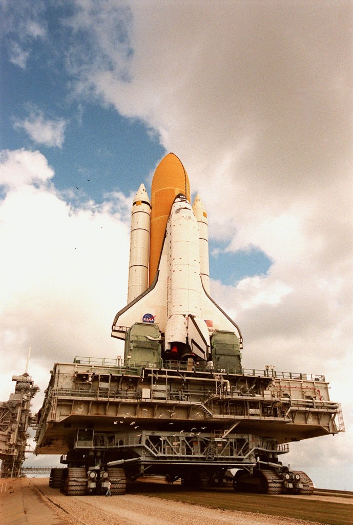 Endeavour rolls out to Launch Pad 39A.
 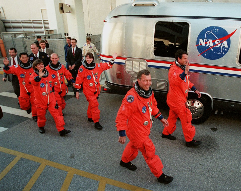 The STS-99 crew walks out of crew quarters for the van ride to the launch pad. Workers rolled Endeavour to the Vehicle Assembly Building on Dec. 2 for mating with its external tank and solid rocket boosters, and then out to Launch Pad 39A on Dec. 13. The astronauts traveled to Kennedy to participate in the Terminal Countdown Demonstration Test Jan. 11-14, returning afterwards to Houston for final training. They traveled back to Kennedy on Jan. 27 for the first launch attempt four days later. After two launch attempts, the STS-99 mission prepared to liftoff on Feb. 11, 2000.
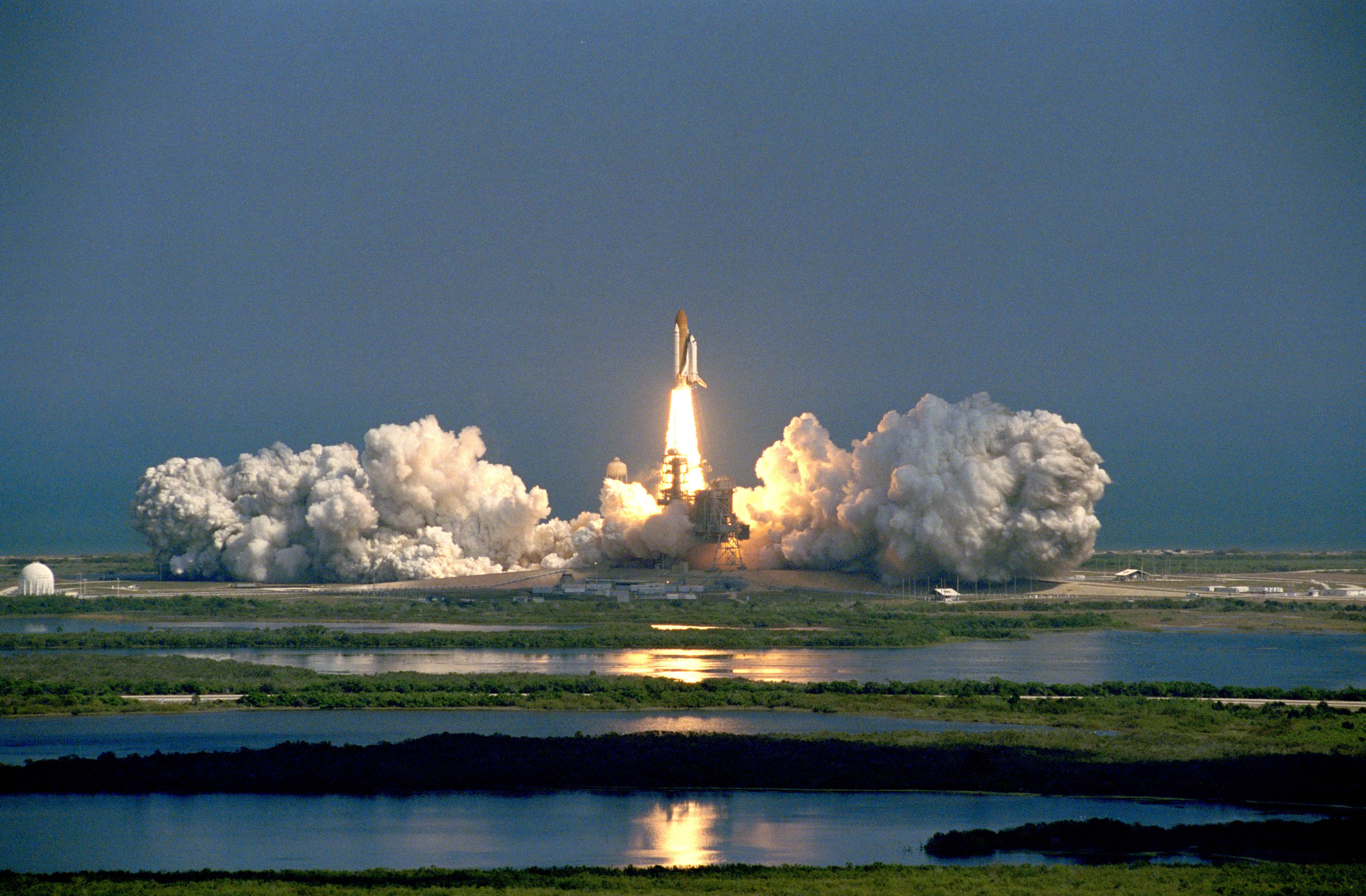 Liftoff! Space shuttle Endeavour takes to the skies to begin the STS-99 mission. At 12:43 p.m. EST, Endeavour thundered into the sky from Kennedy’s Launch Pad 39A to begin the STS-99 mission. Thirty-seven minutes later, a brief firing of the orbiter’s two engines placed Endeavour in the proper 145-mile orbit for the radar scanning.
 The SRTM instruments in Endeavour’s payload bay with the mast holding the second antenna receiver deployed at right.
 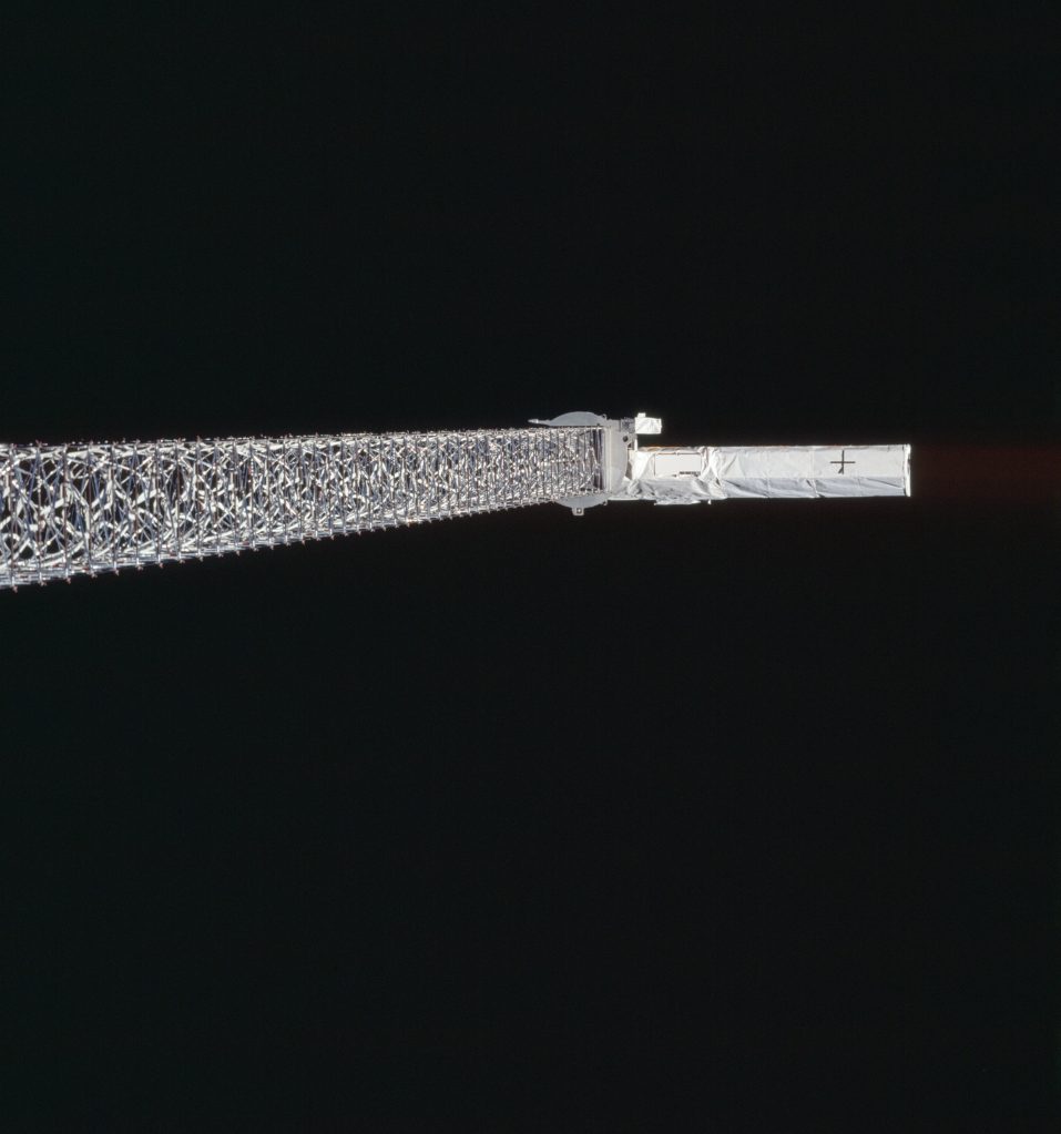 The antenna at the end of the deployed mast.
 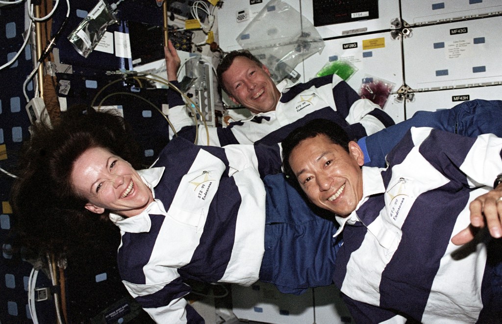 STS-99 astronauts Janet Kavandi, left, Dominic Gorie, and Mamoru Mohri in Endeavour’s middeck.
  Astronaut Janice Voss in the commander’s seat on Endeavour’s flight deck.
  Astronauts Kevin Kregel, left, and Gerhard Thiele on Endeavour’s flight deck. Shortly after reaching orbit, the crew opened the payload bay doors and deployed the shuttle’s radiators. Kavandi and Thiele turned on the instruments, deployed the 200-foot mast, and conducted initial checkouts of the radars. The crew split into two shifts to enable data collection around the clock during the mission. After overseeing the initial activation of the radars, the red shift of Kregel, Kavandi, and Thiele began their first sleep period as the blue shift of Gorie, Voss, and Mohri picked up with activation and began the first data takes.
The major crew activity for SRTM involved changing tapes every 30 minutes. The SRTM generated 332 high density tapes during more than 222 hours of data collection and these recordings covered 99.96 percent of the planned observations. Data collection finished on the mission’s 10th flight day, after which the astronauts reeled the mast back into its container in the payload bay.
 EarthKAM image of the greater Boston area.
 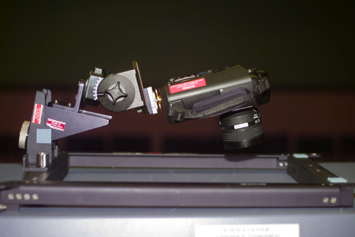 The EarthKAM camera mounted in a space shuttle window.
  STS-99 crew Earth observation photograph of El Paso, Texas, and Ciudad Juarez, Mexico.
 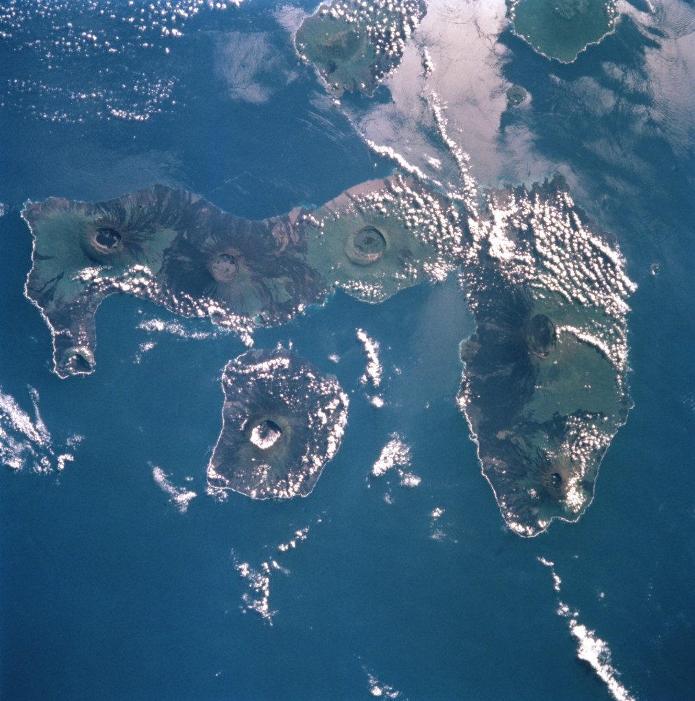 STS-99 crew Earth observation photograph of the Galapagos Islands.
  STS-99 crew Earth observation photograph of the greater New York area.
 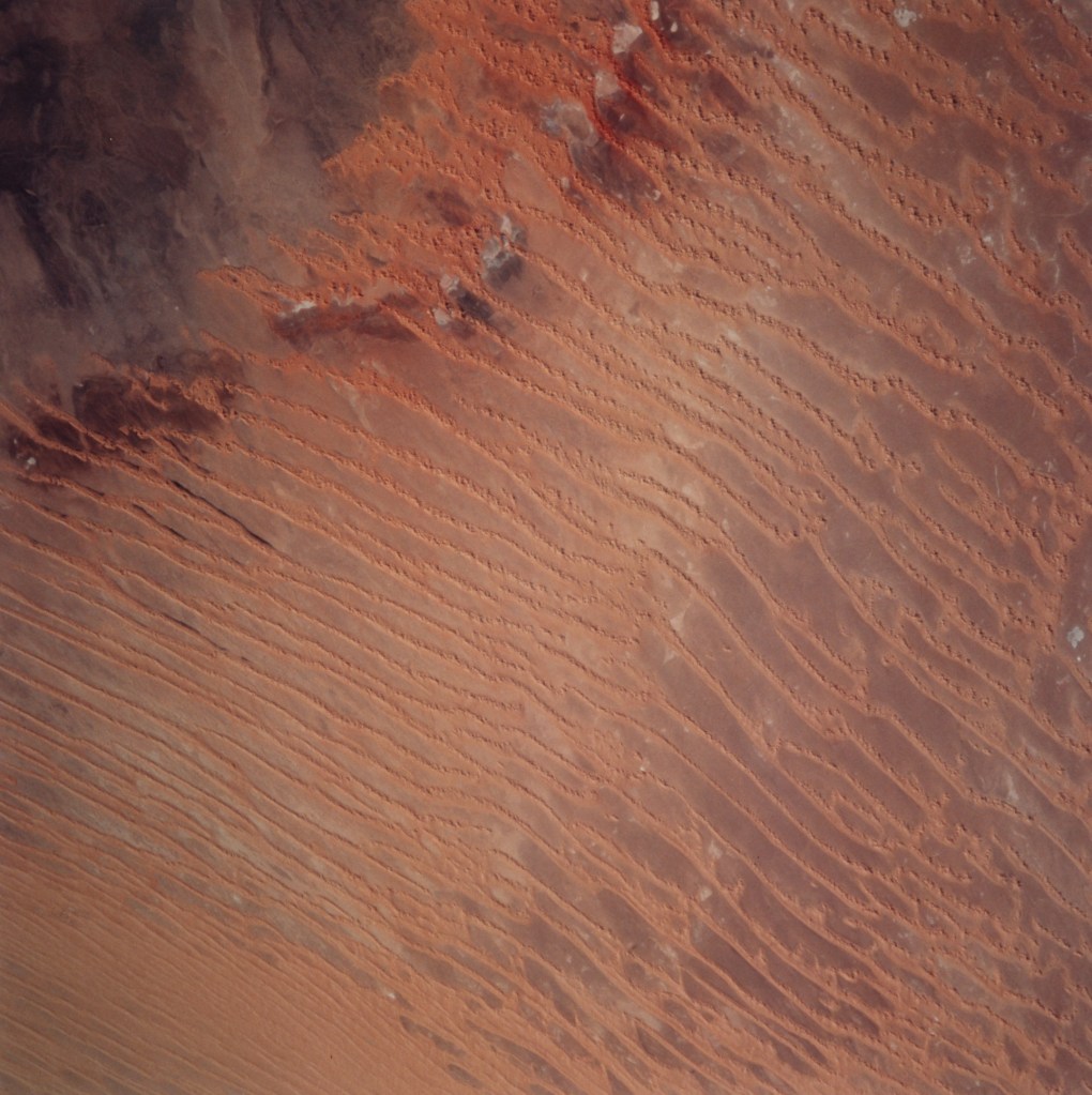 STS-99 crew Earth observation photograph of Erg Chech, or sand sea, in the Algerian Sahara. NASA’s EarthKAM program enabled middle school students to remotely take photographs of the Earth using an electronic still camera mounted in one of the shuttle’s windows. The University of California at San Diego houses the control center for EarthKAM, linked with middle schools via the Internet. Students choose Earth targets of interest, and the camera takes photos of that region as the shuttle passes overhead. A then-record 75 schools from around the world participated in the EarthKAM project on STS-99, the camera returning 2,715 images of the Earth.
The STS-99 astronauts also spent time taking photographs of the Earth using handheld cameras and the high inclination orbit enabled views of some parts of the Earth rarely seen by shuttle astronauts.
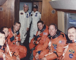
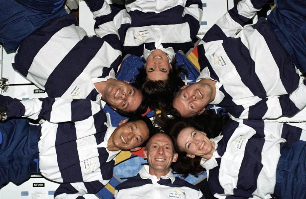 The six-person STS-99 crew pose for their inflight photo.
 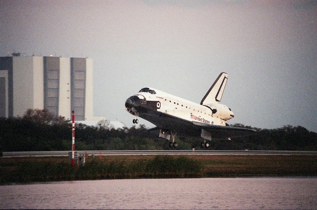 Kevin Kregel guides Endeavour to a smooth touchdown on the Shuttle Landing Facility at NASA’s Kennedy Space Center in Florida.
  The STS-99 crew poses with NASA Administrator Daniel Goldin under Endeavour at the Shuttle Landing Facility at NASA’s Kennedy Space Center in Florida.
  Kevin Kregel addresses the crowd at Houston’s Ellington Field during the welcome home ceremony for the STS-99 crew. On Feb. 22, the crew closed Endeavour’s payload bay doors, donned their launch and entry suits, and strapped themselves into their seats for entry and landing. Kregel piloted Endeavour to a smooth landing on Kennedy’s Shuttle Landing Facility. The crew had flown 181 orbits around the Earth in 11 days, 5 hours, and 39 minutes. Enjoy the crew narrate a video about the STS-99 mission.
Postscript
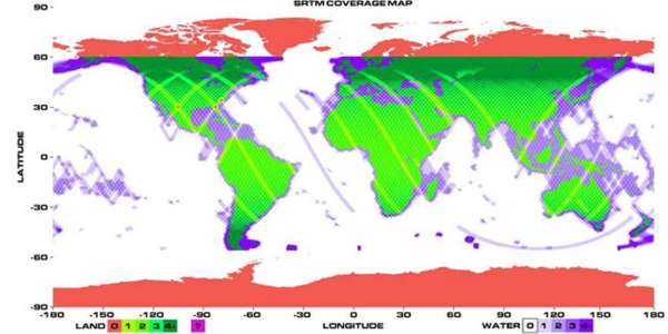 Final coverage map for the SIR-C radar, indicating 99.96 percent coverage of planned land mass targets, with many areas imaged more than once.
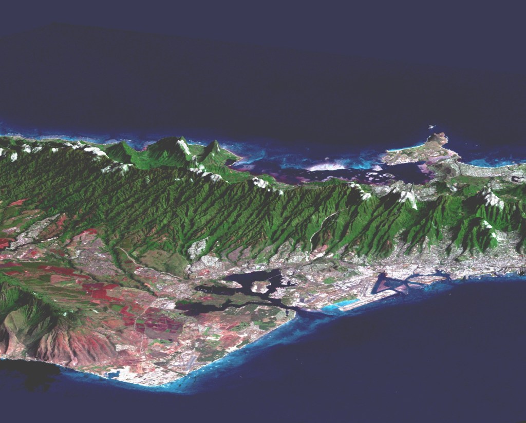 False-color image generated from SRTM data of the island of Oahu.
 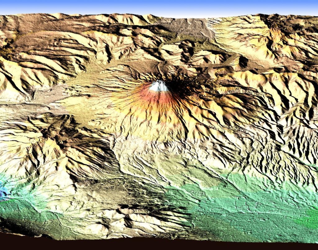 False-color image generated from SRTM data of Mt. Cotopaxi in Ecuador, the tallest active volcano in the world. During the 11-day mission, SRTM collected more than one trillion data points, generating 12.3 terabytes of 3-D data of the Earth. Earnest Paylor, SRTM program scientist at NASA Headquarters in Washington, D.C., called the mission “a magnificent accomplishment.” He cited that SRTM imaged by radar equatorial regions of the Earth previously unmapped due to constant cloud cover.
 12 min read 30 Years Ago: STS-68 The Second Space Radar Lab Mission Article 5 months ago
  22 min read 35 Years Ago: NASA Selects its 13th Group of Astronauts Article 4 weeks ago
  17 min read 30 Years Ago: NASA Selects its 15th Group of Astronauts Article 2 months ago
